Physics-based simulation
Scene Constructor: Large-Scale DIRSIG Scene Simulation

Overview
Scene Constructor is an automated framework for building large-scale virtual landscapes for physics-based remote-sensing simulations in DIRSIG. Designed primarily to support Landsat 10 sensor trade studies, it enables users to evaluate sensor concepts before launch by varying atmospheric conditions, sensor configurations, acquisition geometry, and noise characteristics. The framework integrates satellite-derived surface reflectance, terrain elevation, surface emissivity, atmospheric conditions, and solar-sensor geometry to support simulations across reflective and thermal wavelengths. Using DGGRID-based hexagonal tiling and spatial indexing, it organizes these inputs into reusable, geographically referenced scenes that can be assembled into continuous Landsat-scale regions. By automating data acquisition, preprocessing, and scene construction, Scene Constructor provides a scalable workflow for systematic sensor-performance evaluation and can be adapted to support other remote-sensing platforms.
Interactive demonstration
Landsat Pushbroom Simulation
A closer look
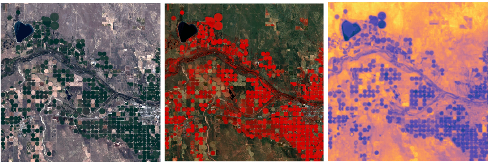
Landsat RGB, Pseudo-RGB, and Thermal Simulations
Scene Constructor was designed and tested across reflective and thermal infrared wavelengths to support Landsat Next studies. These simulated RGB, pseudo-RGB, and thermal images illustrate its potential for applications ranging from vegetation-index calculations, such as NDVI, to developing and evaluating surface-temperature retrieval methods, including temperature–emissivity separation algorithms.
Sentinel-2 Reflectance and Simulated Thermal Imagery
Real-world Sentinel-2 10 m surface reflectance and simulated thermal imagery at 10 m over Tehran, Iran. Scene Constructor first constructs the simulated surface-reflectance product, which is then used with thermal modeling to estimate surface temperature.
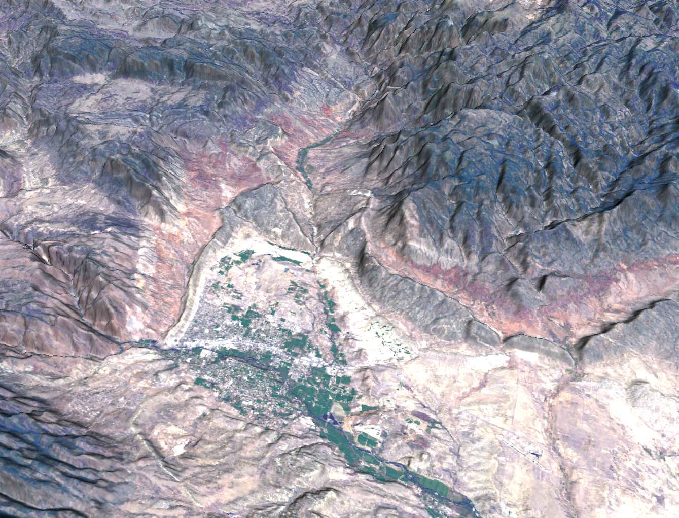
Terrain-Aware Scene Construction
This off-nadir view of Colorado illustrates Scene Constructor’s 2.5D representation of the landscape. A digital elevation model captures terrain relief, while individual trees and buildings are not explicitly represented as three-dimensional objects. Future development could introduce hierarchical levels of detail to incorporate finer-scale structures where needed.
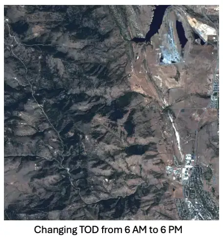
Exploring Changing Illumination
Scene Constructor allows users to vary simulation settings and examine their effects on the resulting imagery. This animation changes the time of day from 6 AM to 6 PM, showing how illumination and terrain shadows evolve across the landscape. Future work could incorporate bidirectional reflectance distribution functions (BRDFs) to represent direction-dependent surface reflectance.
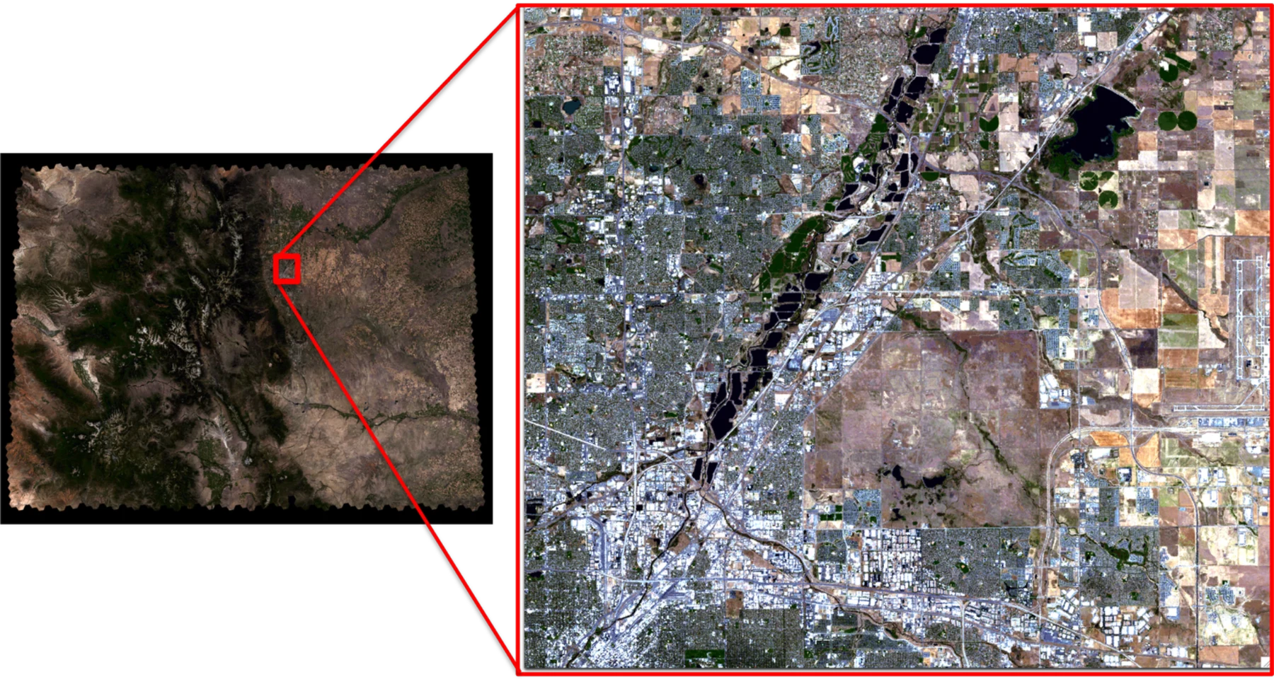
From Landscape to Local Detail
A simulation spanning the entire state of Colorado is paired with a closer view of Boulder at a 10-meter ground sampling distance. Together, these views demonstrate Scene Constructor’s ability to represent broad geographic regions while retaining local spatial detail.

DGGRID Hexagonal Tiling and Spatial Indexing
Scene Constructor uses DGGRID’s hexagonal tiling and spatial indexing system to partition the Earth into geographically referenced tiles. This organization supports large-scale scene assembly and rendering with DIRSIG’s multithreading capabilities. The configuration shown uses aperture 3 and resolution 12, producing tiles approximately 11 km across.
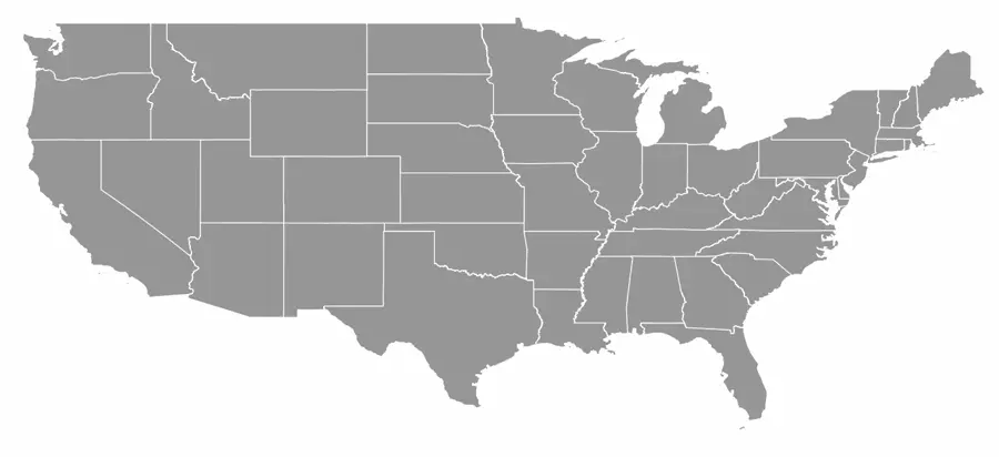
Summer Simulations Across the Contiguous United States
This animation shows Scene Constructor simulations covering the contiguous United States using summer observations from 2020 through 2025. Future work could extend this coverage to other seasons, enabling comparisons across a broader range of surface and environmental conditions.
In the news
NASA awards RIT $2.2 million to extend Landsat satellite-program collaboration
RIT News highlights NASA's new award supporting Landsat 10 sensor trade studies. The collaboration uses large-scale synthetic scenes developed with DIRSIG to generate proxy data for evaluating sensor design and image quality before launch.
Read the RIT News story ↗