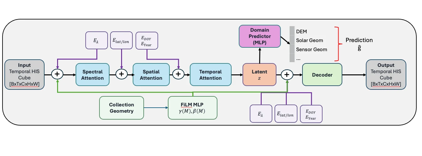
Hyperspectral Foundation Model
Learning spectral, spatial, and temporal representations to study vegetation stress and environmental change.
Earth observation & applied AI
Understanding our world through remote sensing, machine learning, and physical simulation.
Research Assistant Professor
Rochester Institute of Technology
Research & software
From learning representations of Earth to simulating the sensors that observe it.
Learning spectral, spatial, and temporal representations to study vegetation stress and environmental change.
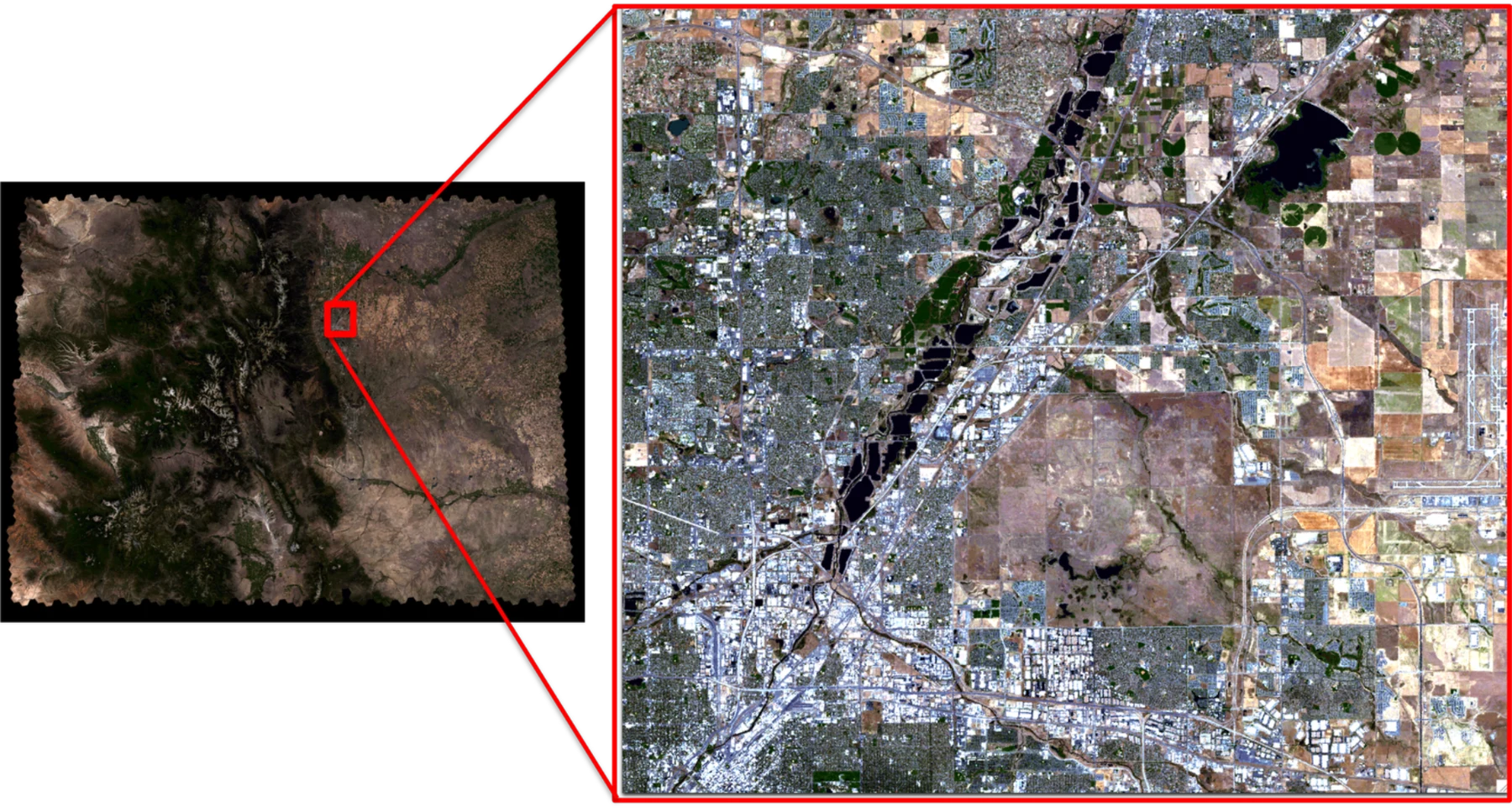
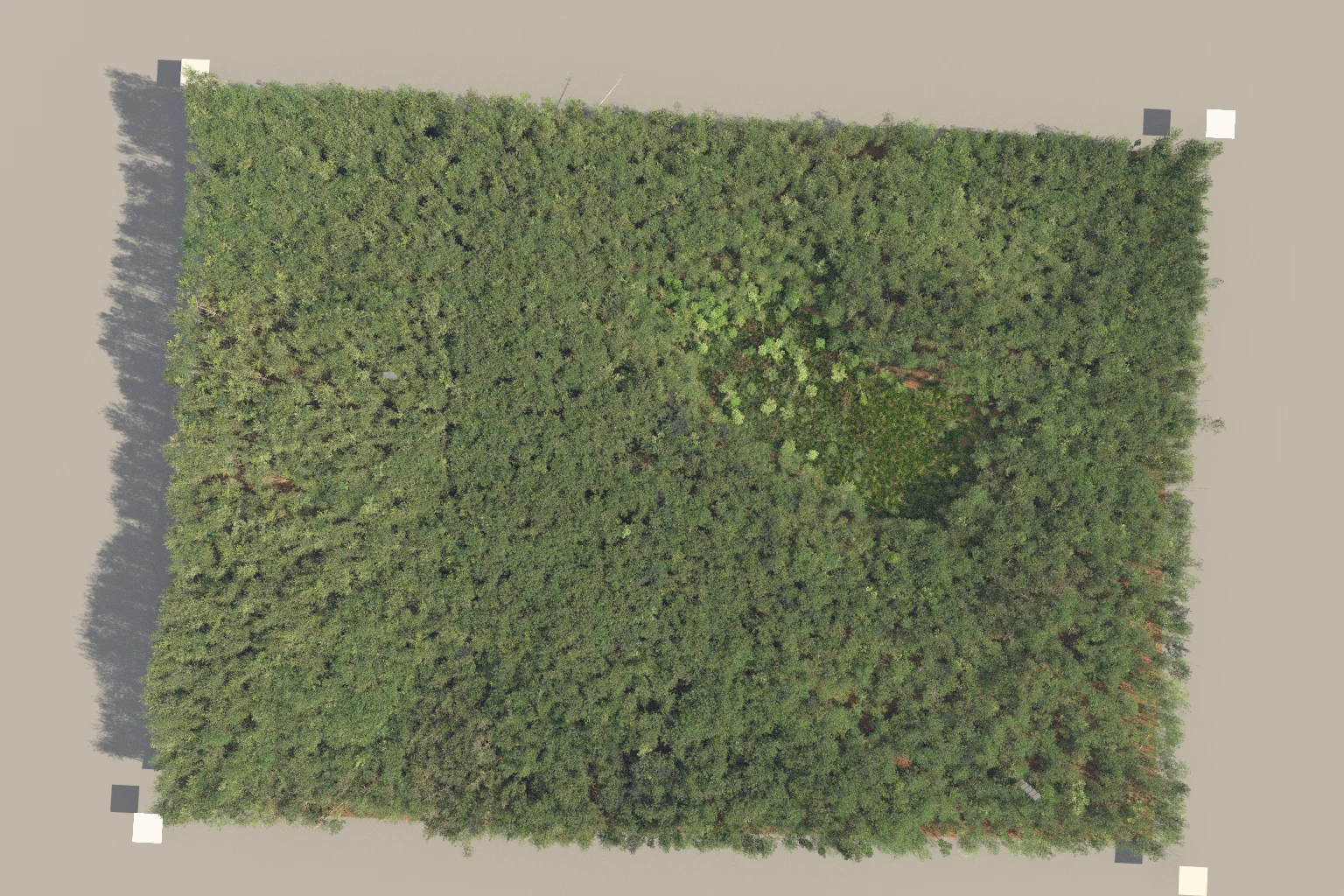
Automated scene construction for Landsat-scale simulations and sensor trade studies.
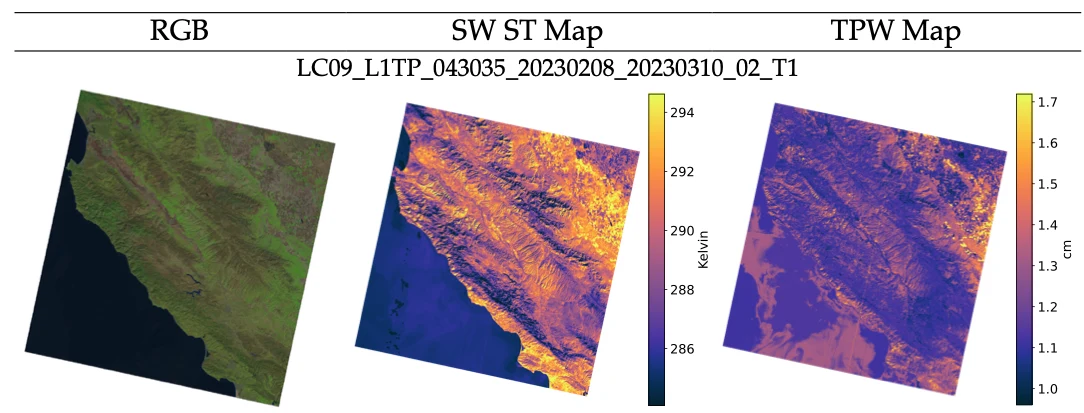
Estimating atmospheric water vapor and propagating uncertainty in Landsat split-window surface-temperature products.
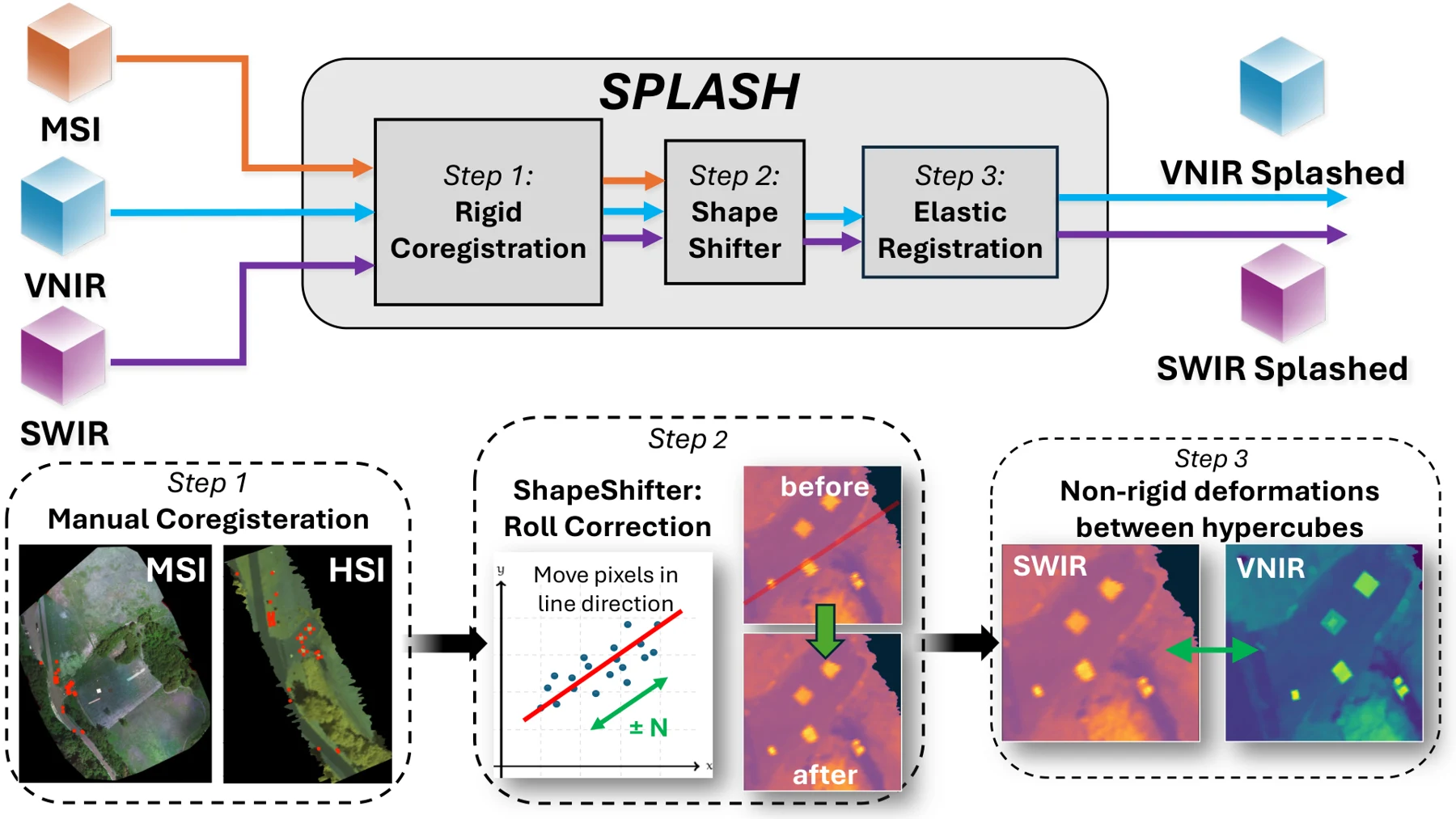
Aligning VNIR and SWIR pushbroom imagery from separate drones through global, row-wise, and elastic correction.
Estimating mixed material percentages inside forest voxels from 3D position and LiDAR intensity.
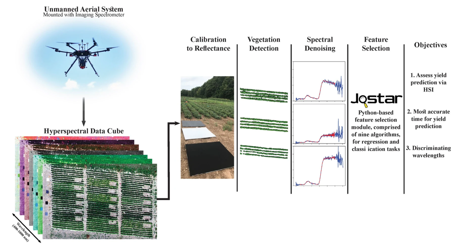
Connecting greenhouse spectroscopy with drone-based field observations for yield prediction and crop maturity assessment.

Nine feature-selection algorithms for regression and classification, with a familiar Scikit-Learn-style interface.
Papers & collaboration
IEEE Transactions on Geoscience and Remote Sensing
Remote Sensing of Environment · In review · Preprint
Computers and Electronics in Agriculture · 230, 109923
Remote Sensing · 15(3), 794
IEEE Journal of Selected Topics in Applied Earth Observations and Remote Sensing · 15, 4027–4044
Ph.D. dissertation · Rochester Institute of Technology
IEEE Transactions on Geoscience and Remote Sensing · 60, 1–17
Remote Sensing · 13(19), 3975
Remote Sensing · 12(22), 3809
Journal of Applied Remote Sensing · 14(2), 024519
I am a Research Assistant Professor at Rochester Institute of Technology, working at the intersection of remote sensing, machine learning, and physics-based simulation. I develop methods and software for extracting meaningful information from satellite, drone, hyperspectral, thermal, and LiDAR observations.
My work spans self-supervised geospatial foundation models, Landsat surface-temperature retrieval and uncertainty, large-scale DIRSIG scene construction, and agricultural monitoring. I earned my Ph.D. in Imaging Science from RIT in 2022, where my research connected greenhouse spectroscopy with drone-based crop yield and harvest-maturity assessment.
I also teach Applications of Machine Learning in Remote Sensing and advise graduate and undergraduate researchers. Earlier industry experience at AgerPoint and PrecisionHawk informs my focus on practical, usable research software.
Research, collaboration, and opportunities.